
The Best Miata Drives Along California
Searching for the best Miata drives in California? Check this hand-picked bunch for the lightweight agility of the Mazda MX-5. Read on to plan a top-down road-trip that pairs canyon curves, coastal vistas, and high-country passes into one unforgettable California adventure.


Searching for the best Miata drives in California? Check this hand-picked bunch for the lightweight agility of the Mazda MX-5. Read on to plan a top-down road-trip that pairs canyon curves, coastal vistas, and high-country passes into one unforgettable California adventure.
Why California + Miata Just Works
California packs deserts, snow–capped passes, vineyard-draped valleys, and wave-pounded coastline into one state. A feather-weight MX-5 thrives on that variety: it skips over frost heaves, pivots through blind hairpins, and idles in Napa traffic without boiling its coolant. Treat the routes below like a choose-your-own-adventure. You can fire off a single segment before lunch or string the whole lot into a week-long epic that lets you taste every biome the Golden State offers.
CA-4 , Ebbetts & the Angels Camp Traverse
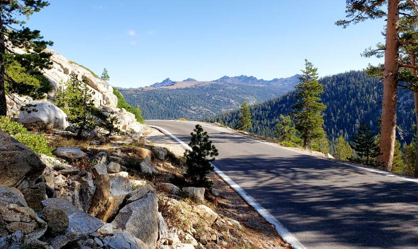
Roughly 120 miles stretch between Topaz Lake and Copperopolis, climbing to 8,730 feet over Ebbetts Pass. July through early October is your window; snow gates often stay locked until midsummer. Second-gear hairpins stacked on eight-percent grades keep the tach happy, while granite walls bounce your exhaust straight back into the cockpit. The asphalt narrows to one lane with no guardrails, so pull-outs are your friend, stop, breathe in the alpine air, then dive back into the bends. Desert sweepers lure you toward Markleeville, pinched tarmac and tall pines carry you past Lake Alpine, and wider curves roll you down to the warmer foothills near Angels Camp. Grab picnic supplies at the Lake Alpine store, then eat twenty paces away on the lakeshore. If time allows, pitch a tent under Hermit Valley’s star-soaked sky or wander beneath the 250-foot sequoias in Calaveras Big Trees State Park.
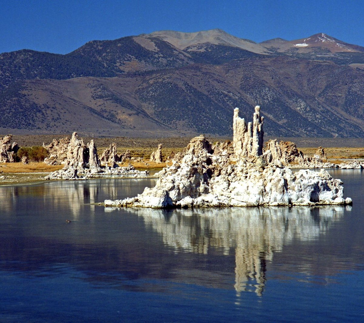
CA-120 , Mono Lake to Oakdale over Tioga Pass
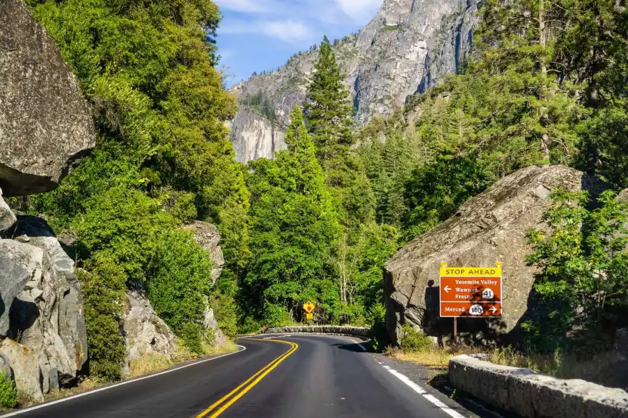
In 208 miles you’ll tick off alkali flats, snow-spined Sierra peaks, glacier-polished granite domes, and sun-baked oak foothills. Tioga tops out at 9,945 feet, and the climb is steep enough that a tired 1.6-liter NA feels like it’s missing a cylinder, test your cooling system before you leave the driveway. Sunrise near Benton Crossing paints the eastern range pink; half an hour later Mono Basin’s tufa towers glow gold. From Lee Vining the road claws three thousand feet in twelve miles to the park gate. After cresting Tioga, stretch your legs at Tuolumne Meadows or amble up to Olmsted Point for a front-row view of Half Dome. If you want Yosemite Valley without the traffic, sneak in at dawn; otherwise roll west, let the four-lane foothill highway settle the revs, and reach Oakdale in time for dinner. Afternoon thunderheads can freeze the summit, so cross the high point before lunch whenever possible.
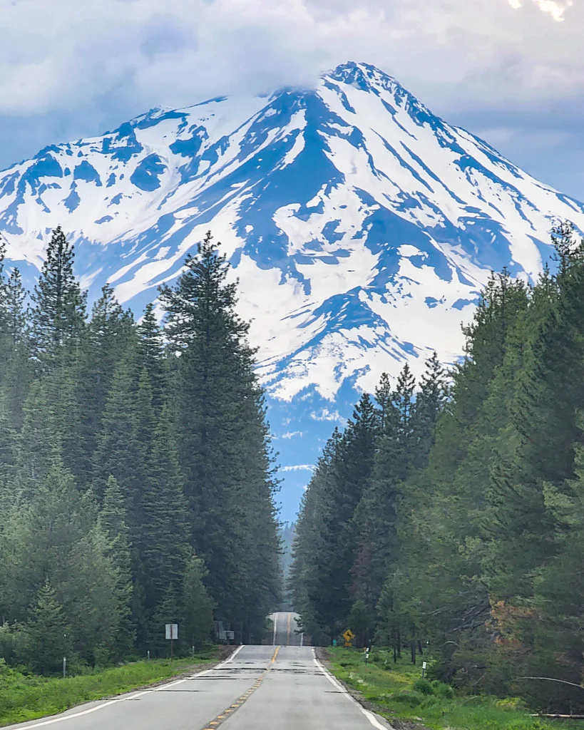
CA-89 , Tahoe Rim to Mount Shasta “Ridgeline Ramble”
Need two mountain ranges in one go? CA-89 delivers about 240 miles of tarmac that samples the Sierra Nevada first and the Cascades second, usually on fresh chip-seal laid after each snow season. Fuel stops masquerade as tiny lodge towns that pour espresso beside the pump and keep 91-octane on tap. Roll out early to catch Emerald Bay’s turquoise water before the tour buses. The historic granite snow sheds on Donner Pass double as a photo backdrop nobody else in your feed has. A late-morning cruise lands you in Graeagle, where a patio burger comes with meadow views and grazing deer. Past town, sulfur fumaroles and treeline twisties inside Lassen Volcanic National Park make you feel like you’ve slipped across the Atlantic to Iceland. Just before Shasta, an icy plunge at McCloud Falls erases every knot in your shoulders.
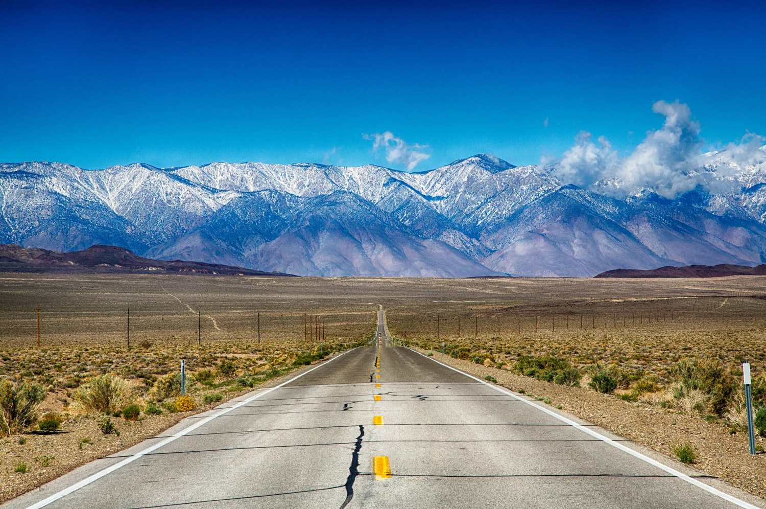
US-395 , The Eastern Sierra Backbone
Picture 310 miles of valley floor flanked by snowy peaks so close you can trace their couloirs from the driver’s seat. You can blast it in a day or meander for two. Leaving Adelanto, Mojave scrub stretches wide and flat; Red Rock Canyon turns orange at sunset. North of Lone Pine the Alabama Hills’ knuckled boulders frame the Sierra in Cinemascope, a short dirt side road rewards even a stock-height Miata. A few minutes later the sobering exhibits at Manzanar’s WWII relocation camp put everything in perspective. Bishop smells like high-country sage and jerky smoke; from there, volcanic domes usher you toward Mammoth, where McGee Creek’s switchbacks climb to an alpine trailhead. Hot-spring basins pepper the section to Bridgeport, and Travertine’s dirt spur is mild enough for street tires. The last push runs through Walker River canyon and spits you out beside the glassy surface of Topaz Lake. Expect three climbs above eight thousand feet, carbureted engines may go lean, and forty-degree swings between day and night, so pack layers. CHP radar often lurks on the downhill into Bishop, so keep the needle sensible.
Northern California Snapshot Stops
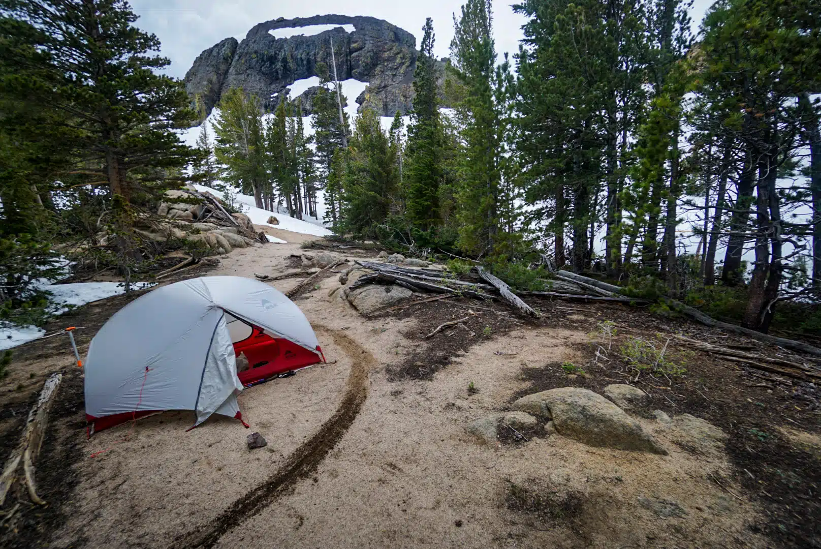
Mono Lake’s South Tufa area charges three bucks, offers vault toilets, and serves up lunar limestone towers at golden hour. Mountain Gate Park hides beside a snow-fed river where you can dunk head-to-toe, though you’ll lose cell signal the moment you park. Monitor Pass Vista at 8,314 feet squeezes just four cars but unveils Antelope Valley like an IMAX screen. Calaveras Big Trees asks ten dollars at the gate and guides you along an easy loop under 250-foot giants, with campsites that let you fall asleep staring at the Milky Way. Glacier Point’s seasonal road, generally open May to November, ends on a 3,200-foot cliff opposite Half Dome, few drives feel more dramatic. If wine calls, start in Calistoga, glide down Silverado Trail, cut east over Howell Mountain Road, and loop north on Highway 29; several estates allow overnight parking so you can sample responsibly. When coastal fog beckons, exit US-101 onto River Road and follow the Russian River to Jenner, palm groves, vineyards, redwood tunnels, and Pacific surf all unspool in under thirty miles; bring a hoodie because the fog rolls in by six.
Pack Light, Pack Smart
Stash a quart of oil, a liter of premixed coolant, a low-profile jack pad, and a torque wrench, then make sure the brake fluid is fresh, long alpine descents love to roast tired rotors. Comfort is a wide-brim hat for top-down sun, a collapsible windshield shade for trailhead parking, and a couple of microfiber towels that double as seat covers after a river swim. For self-rescue carry a plug kit, a mini-compressor, and a fifteen-foot tow strap; cell reception evaporates north of the last town. Navigation back-ups mean a paper Sierra Nevada road map and a handheld GMRS tuned to channel 16, overlanding locals monitor it and can relay emergencies. Finally, mount an action cam on the windshield to dodge chip-seal vibration and keep an ND filter handy for canyon photos at high noon.
Itinerary Ideas
If you have one weekend, leave Sacramento before dawn, climb CA-4 from west to east and camp in Arnold. At sunrise blast over Ebbetts, drop down Monitor Pass, and cruise CA-89 north to a Lake Tahoe dock-side dinner, roughly 485 miles in two days. Five days buys you Sacramento to Sonora Pass, then a northbound romp up US-395 to Mammoth; pop over Tioga into Yosemite, overnight in the Valley, follow CA-89 to Shasta, and sprint home on the interstate, about 720 miles of grin. A full week lets you stitch Big Sur’s cliffs, the Russian River redwoods, Napa’s winery loop, CA-4’s granite corridors, US-395’s hot springs, and a Tahoe paddle-board session into one 1,050-mile coast-to-crest odyssey.
Spend a week in a Miata on California back roads and you’ll swear you crossed a continent: desert slot canyons at breakfast, snow-banked passes by lunch, vineyard glow at sunset. Service the cooling system, pack a light duffel, and remember, tiny cars own the biggest roads. See you out there.


