
Colorado’s Scenic Drives for your Miata (2025)
Colorado serves up some of the best Miata playgrounds in the U.S. Expect details on distance, elevation, driving character, ideal times of day, crowd patterns, fuel and food stops, photo ops, and potential hazards.


You’re chasing smooth tarmac, rhythm corners, big altitude, and low-drama logistics. Every route below is fully paved unless noted. Know the typical distance, elevation range, best time of day, driving character, crowd patterns, fuel and food notes, photo stops, and hazards. Always check day-of conditions and fire/rockfall alerts before you go.
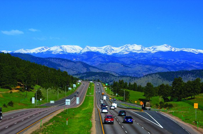
Lariat Loop Scenic Byway (Golden to Evergreen)
Think of this as your chassis warm-up: roughly 40 miles of historic grades and hillside neighborhoods stitched together by Lookout Mountain Road’s hairpins. Expect 20–35 mph posted limits on the climb and steady cyclists in the morning. Best run is sunrise or late afternoon on weekdays when the overlook parking isn’t jammed. Elevation spans about 5,300–7,400 feet, so power loss is mild but noticeable; short-shift and keep momentum out of the tightest corners. Fuel and coffee are easy in Golden and Evergreen. Must-stop views: Windy Saddle Park and the Boettcher Mansion overlook. Hazards include wandering deer and gravel in inside radii after summer storms.
Peak to Peak Scenic Byway (Estes Park to Nederland/Central City)
Colorado’s oldest scenic byway strings 50-plus miles of foothill sweepers along the base of the Divide. Expect mostly 45–55 mph two-lane with frequent passing zones and a few decreasing-radius surprises at town entries. Elevation ranges from roughly 8,200 to just over 9,300 feet. Run northbound early for sunlit peaks, or southbound late for alpenglow. Weekdays are calm; September weekends can stack up with leaf-peepers. Fuel is easy in Estes Park and Nederland; services thin out between Ward and Rollinsville. Good spur roads include South St. Vrain Canyon and Golden Gate Canyon for extra variety.
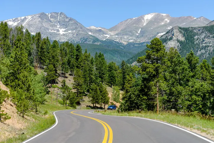
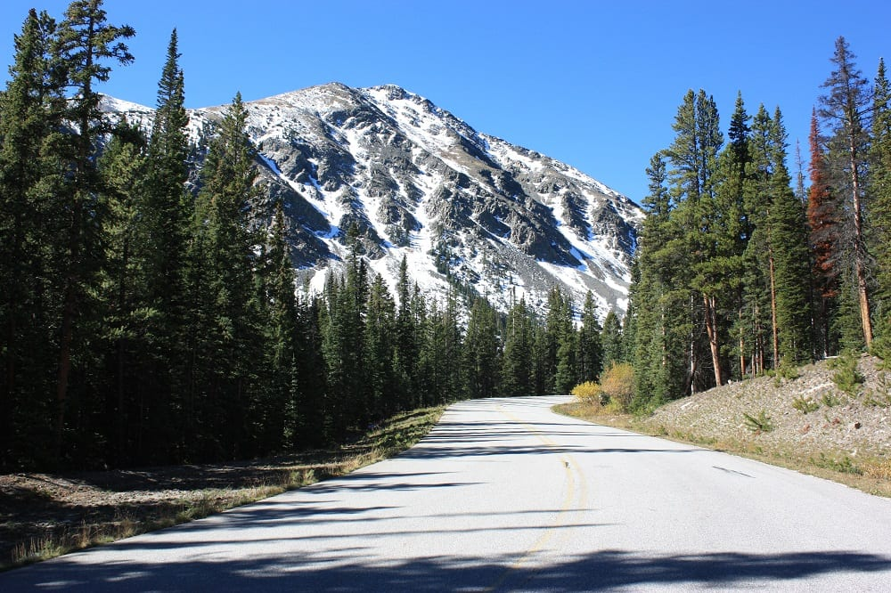
Trail Ridge Road, Rocky Mountain National Park (Estes Park to Grand Lake)
This is the big one: about 48 miles cresting at 12,183 feet with long, sweeping vistas across true alpine tundra. Plan 2–3 unrushed hours including turnouts and short walks. Midday typically requires a timed-entry reservation in peak season, and a park entry fee applies. Winds can be strong above treeline; temps can swing 30 degrees between valley and summit even in July. Pullouts at Forest Canyon and Lava Cliffs are ideal photo spots. Miata notes: at 12k feet a naturally aspirated car feels roughly a third down on power; use momentum and leave extra runway for passes. Watch coolant and oil temps on the long climb; let the car idle a minute at major stops.
Guanella Pass Scenic Byway (Georgetown to Grant)
A compact 24-mile summit road with alpine meadows, hairpins, and wide-open panoramas. Typical elevations run 8,500–11,700 feet. Surface is smooth chip-seal to asphalt with a few frost-heave ripples near the top. It usually opens around late May and closes with the first sustained snows in late fall. Morning runs from Georgetown give you sun on the switchbacks; afternoons from Grant light up the peaks. Fuel and food are in Georgetown and Bailey (a short detour from Grant). Wildlife is common near the lakes, scan ahead through longer bends.
Independence Pass (CO-82: Aspen to Twin Lakes/Leadville)
A crown-jewel 32-mile crossing topping out at 12,095 feet, with narrow lanes, cliff exposure, and multiple slow-speed squeezes through rock cuts. Expect a strict length restriction and frequent pullouts. Best plan is an early weekday, eastbound from Aspen for less glare in the canyon. Elevation changes and shade make tire temps swing; a quick pressure check in Twin Lakes or Aspen keeps the ride consistent. Good picnic stop at the summit boardwalk; short hikes fan out in all directions.
Cottonwood Pass (Buena Vista to Taylor Park/Almont)
Fresh pavement and big, flowing radii define this ~26-mile Divide crossing. Elevation crests around 12,100 feet, but grades are smoother than Independence, so the car breathes easier. Base yourself in Buena Vista for easy fuel and food; run westbound mid-morning for warm tires on the descent into Taylor Park’s sweepers. If storms pop, the east side generally dries faster, pivot your loop accordingly.
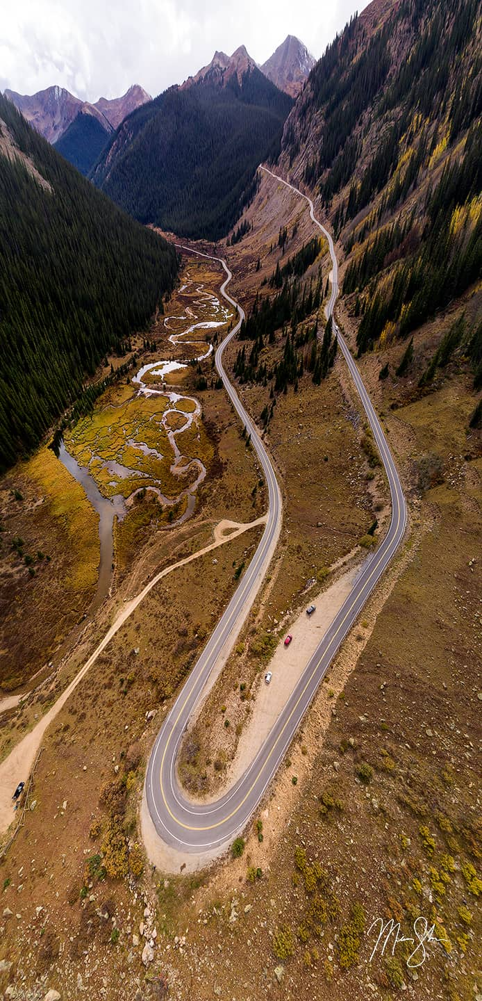
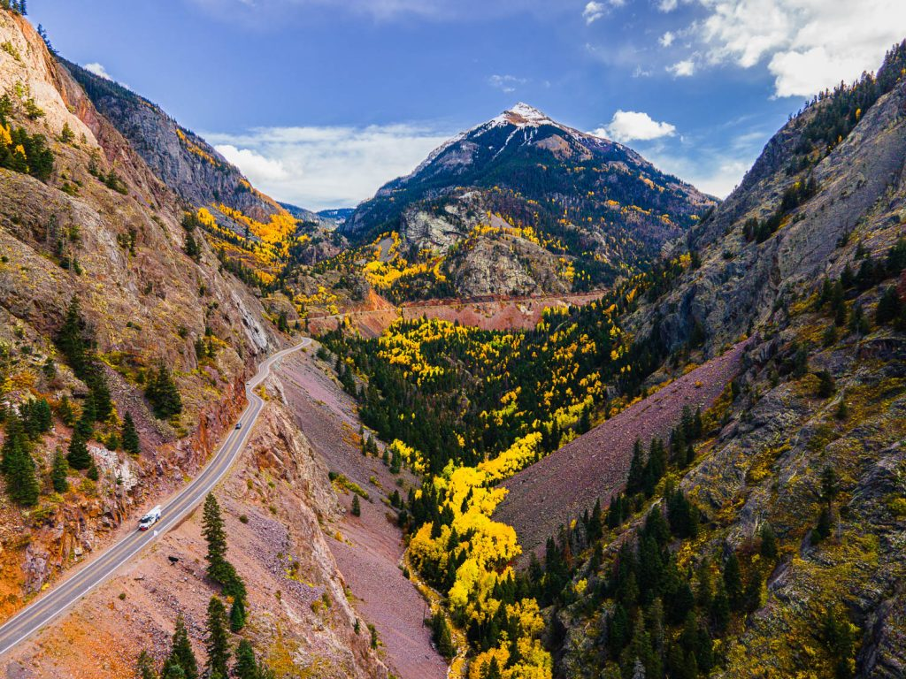
San Juan Skyway + “Million Dollar Highway” (US-550 via Ouray/Silverton/Durango)
An all-timer linking multiple passes above 10,000 feet with dramatic exposure and tight, stacked corners. Plan at least two days to enjoy overlooks, mining ruins, and hot springs. Morning descents from Red Mountain Pass are easiest on brakes; afternoons bring more traffic and potential thunder showers. Miata notes: use engine braking early, square off tight hairpins with a patient entry, and avoid pad glaze by giving the car a few minutes of easy running after major downhill sections.
When to Go and What It Costs
High passes typically open near late May and close around late October or early November, but storm tracks can move those goalposts by weeks. Timed-entry is common on headline roads inside national parks during peak months, and standard park or toll fees apply. If you’re leaf-hunting, aim for mid-September to early October, staging your loop so you cross multiple elevation bands over a few days for rolling color.
Practical Miata Tips at Altitude
Power & gearing: Figure roughly three percent power loss per 1,000 feet for naturally aspirated cars. Keep momentum, short-shift on climbs, and plan passes with generous margins.
Cooling & brakes: Long grades reward preventive thinking, upshift earlier than you would at sea level and lean on engine braking. After big descents, cruise gently for a few minutes to cool pads and fluid.
Tires & pressures: Morning cold can drop pressures; a quick check before high-speed sections keeps feel consistent.
Weather & kit: Above 10,000 feet, storms build fast. Pack a light puffer, rain shell, hat, sunscreen, and extra water.
Road etiquette: Use pullouts to let faster locals by, expect cyclists on many byways, and leave extra space for wildlife at dawn and dusk.


